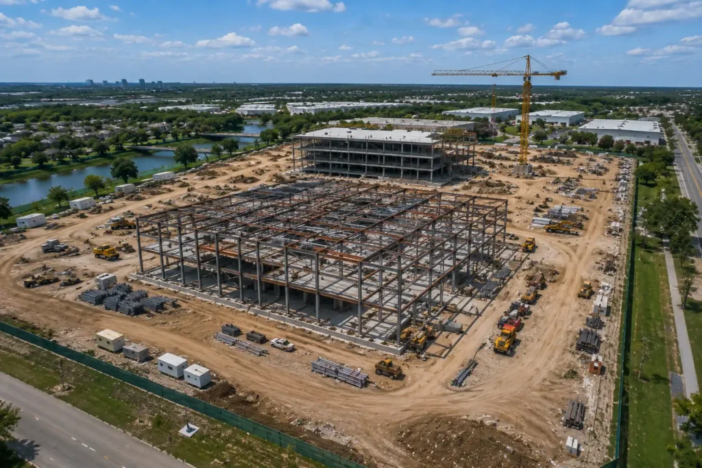
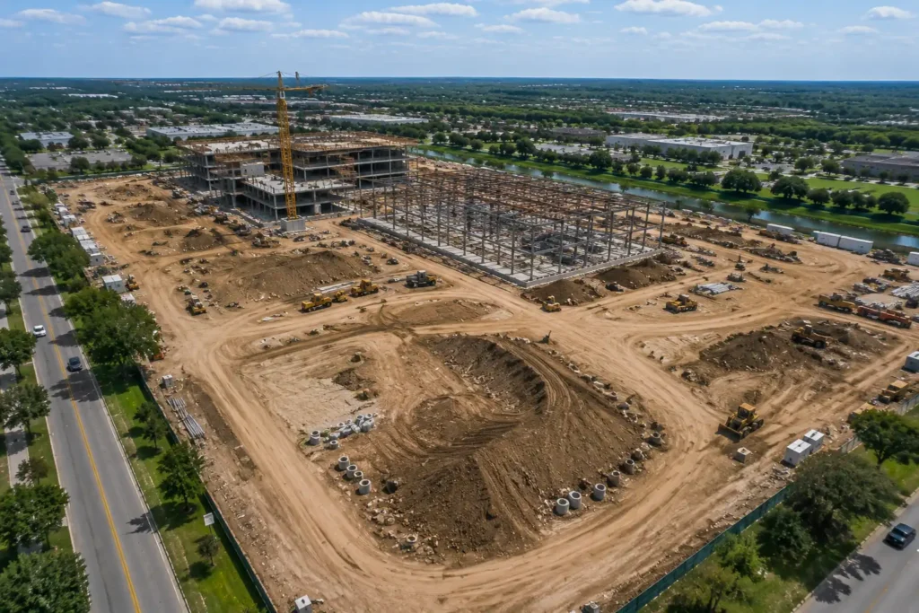
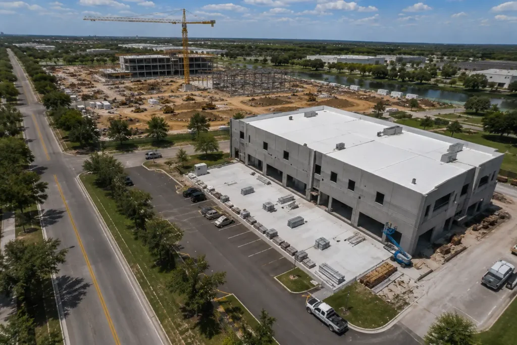
CONSTRUCTIONMONITORING SERVICES
Track progress. Improve efficiency. Reduce risk. Our drone services provide accurate, up-to-date visual
data to keep your projects on schedule and within budget.
Progress Tracking
Regular aerial updates help you track milestones and keep projects on schedule.
Improve Efficiency
Identify issues early, streamline workflows, and keep your project moving forward.
Reduce Risk
Minimize rework, improve safety oversight, and reduce costly delays.
Detailed Reporting
High-resolution images, maps, and reports for better decision-making and clear communication.
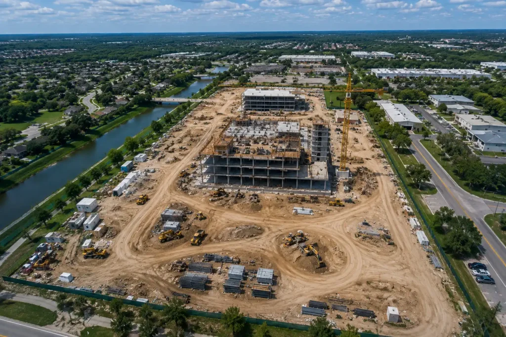
Site Overview
Complete aerial overviews of construction sites for documentation and planning.
Progress Tracking
Track project development and milestones over time.
Cut & Fill Analysis
Aerial analysis for grading, earthwork, and stockpile management.
Before & After Comparisons
Compare project progress and completed phases with repeatable imagery.
Overview
SCAN provides comprehensive drone monitoring solutions for construction projects of all sizes. Our
aerial data gives you the visibility you need to manage your project with confidence.
What's Included
- Progress photos & videos
- Site overview flights
- Cut & fill documentation support
- 3D maps & models (if needed)
- Volume calculations
- Milestone documentation
- Custom reporting
Best For
- General Contractors
- Construction Managers
- Developers
- Engineers
- Architects
- Owners & Stakeholders
- Public Works Projects
Why Choose SCAN?
- Licensed & insured drone pilots
- Advanced imaging technology
- Accurate, reliable data
- Improve project communication
- Save time & reduce costs
- Local team you can trust